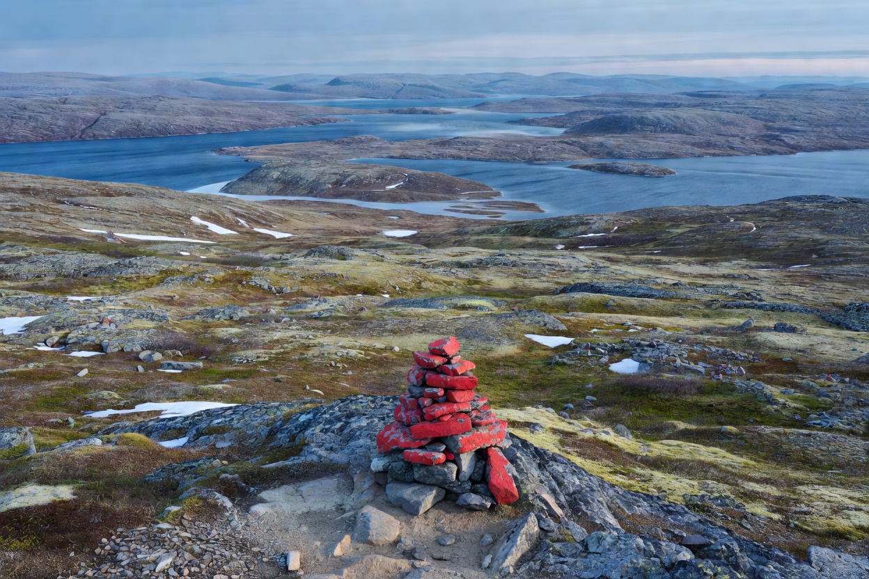
The Character of the Nordic Trail
If you're accustomed to deeply cut dirt paths flanked by switchbacks, the Scandinavian trail system will look disorientingly sparse at first. Above the birch tree line—which sits surprisingly low between 600 and 900 meters in Arctic latitudes—trails often resemble open boulder fields marked by occasional red Ts painted on rock faces (Norway's DNT system) or orange-tipped wooden posts driven into peat (Sweden's STF routes).
There are rarely guardrails. You won't find steps carved neatly into steep pitches. The ethos assumes hikers possess basic wilderness awareness: you look where you step, you gauge stream depth before unbuckling your backpack hip belt, and you understand that if fog descends, following a compass bearing across a trackless fell is part of the afternoon's work.
Trail Difficulty & Elevation Reality
One common trap for newcomers is examining an elevation profile and thinking, "That's only 600 meters of vertical climb; I can knock that out in ninety minutes." Not here. A 600-meter climb in western Norway often starts directly from sea level at the fjord's edge, ascending through wet birch roots, slippery moss-slicked boulders, and loose scree at a 35-degree angle.
Furthermore, "distance" in fell country is measured in hours rather than kilometers. Crossing three kilometers of saturated cloudberry mire or ankle-twisting talus can easily consume two hours. Plan your daily distances around 12 to 18 kilometers when carrying a full pack, rather than the 25 to 30 kilometers you might comfortably maintain on groomed Alpine pathways.
Navigation: Red Cairns, Summer Marks & GPS
GPS receivers and downloaded offline smartphone maps (such as Norgeskart or Topo GPS) are fantastic tools, but you cannot rely on batteries in cold mountain air. Temperatures at 1,000 meters can drop to 2°C in July, sapping lithium batteries within hours.
- Always carry paper maps: Keep a 1:50,000 topographic sheet in a waterproof case inside your outer jacket pocket.
- Understand cairn spacing: In good visibility, cairns are usually visible within 50 to 100 meters. In mountain mist, visibility shrinks to five meters. If you lose the markings, do not wander aimlessly down-slope into ravines; backtrack to the last confirmed cairn.
- River Fords (Vadesteder): Unbridged glacial streams swell rapidly after midsummer afternoons due to meltwater. Cross early in the morning when levels are lowest, unfasten your hip belt so you can ditch the pack if you slip, and keep neoprene booties or old trail runners for river crossings. Never ford barefoot.
Seasonal Windows & Daylight Shifts
The hiking calendar in the far North is concise:
- June: Thaw season. Snow remains deep on high passes. Bogs are inundated, and rivers are roaring torrents. Great for 24-hour midnight sun, but demanding underfoot.
- July to Mid-August: Prime season. Mountain huts are staffed, wildflowers bloom across the tundra, and mountain lakes are ice-free. Be prepared for mosquitoes in sheltered valleys.
- Late August to September: The golden window (known as Ruskidag in Finland). Sub-Arctic birch turns fiery crimson, insects disappear with early night frosts, and the first northern lights flicker across crisp night skies. Snow can dust summits without warning.
Hiking Environment Comparison
| Environment | Typical Terrain | Key Challenge | Best For |
|---|---|---|---|
| Forest Trails (Taiga & Pine) | Pine needle carpets, bog boardwalks, roots | Navigation through dense tree lines, summer insects | Beginners, shoulder season, foul-weather shelter |
| Coastal & Fjord | Sheer granite steps, sea cliffs, exposed wet slabs | Severe wind gusts, rapid maritime fog changes | Breathtaking vistas, direct sea-level ascents |
| Arctic Fells (Tundra) | Exposed talus, lichen, boulder fields, shallow bogs | Total exposure to sub-polar wind, lack of trees | Expedition hikers, wide horizons, wild camps |
| Long-Distance Routes (Kungsleden, etc.) | Mix of river crossings, tundra, suspension bridges | Sustained pack weight, re-supply logistics | Multi-day backpackers, hut-to-hut transitions |
Footwear, Clothing & Trail Costs
Trail runners have gained enormous popularity worldwide, but for multiday backcountry travel across Scandinavia, stout waterproof leather or synthetic boots with deep Vibram lugs remain king. You will step into peat bogs; your feet will get wet unless your footwear features substantial gusseted tongues and ankle stability against rolling boulders.
Regarding trail costs: public footpaths are free throughout Northern Europe thanks to customary access laws. However, if you utilize staffed mountain stations (such as those run by the Norwegian Trekking Association DNT or Swedish Tourist Association STF), expect to pay roughly €35–€65 per night for dormitory bunks if you are a member, or €55–€95 for non-members. Self-service cabins operate on trust boxes or credit card apps—carry local currency notes just in case satellite uplinks fail.